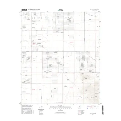
2017 Map of Capitol Dome
USGS Topo · Published 2017About this map
The high desert landscape south of Deming unfolds across this survey, dominated by the northern reaches of the Florida Mountains. The terrain transitions from the suburban grid of southeast Deming and the smaller clusters at La Hacienda and Sunshine into a complex system of volcanic peaks and arroyos. Geographic landmarks such as Capitol Dome, Dragon Ridge, and Chimney Point define the local skyline, while the drainage patterns of Capitol Dome Draw and Mexican Canyon illustrate the arid hydrology of the region. Local water sources like Tubb Spring provide critical points of interest in this dry environment. The map details an extensive network of county roads and residential streets, including Dona Ana Rd SE and Country Club Rd SE, reflecting the modern expansion of Luna County communities into the surrounding basin floors and alluvial fans.
Find a feature on this map
187 named features on this map. Tap any name to fly to it.
Don’t see what you’re looking for? This feature index may not catch every label — zoom into the map to look around manually.
Map Details
Editions of this 2017 Capitol Dome Map
This is the sole edition of this map. No revisions or reprints were ever made.
Other maps of this area

1899 · Deming
USGS Topo · 1:125,000

1915 · Deming
USGS Topo · 1:125,000

1955 · Las Cruces
USGS Topo · 1:250,000

1958 · Las Cruces
USGS Topo · 1:250,000

1964 · Gym Peak
USGS Topo · 1:24,000

1964 · Deming West
USGS Topo · 1:24,000

1964 · Florida Gap
USGS Topo · 1:24,000

1965 · South Peak
USGS Topo · 1:24,000

1965 · Deming East
USGS Topo · 1:24,000
1965 · Midway Butte
USGS Topo · 1:24,000