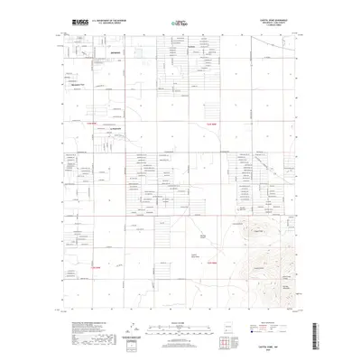
2020 Map of Capitol Dome
USGS Topo · Published 2020About this map
The southeastern outskirts of Deming transition abruptly from gridded residential streets into the dramatic northern foothills of the Florida Mountains. This 2020 survey documents the modern layout of neighborhood expansions like Mountain View, Ventura, and La Hacienda, which sit against a backdrop of prominent volcanic landforms. The landscape is defined by its drainage patterns and sharp elevation changes, notably through Mexican Canyon and the Capitol Dome Draw.
Find a feature on this map
138 named features on this map. Tap any name to fly to it.
Don’t see what you’re looking for? This feature index may not catch every label — zoom into the map to look around manually.
Map Details
Editions of this 2020 Capitol Dome Map
This is the sole edition of this map. No revisions or reprints were ever made.
Other maps of this area

1899 · Deming
USGS Topo · 1:125,000

1915 · Deming
USGS Topo · 1:125,000

1955 · Las Cruces
USGS Topo · 1:250,000

1958 · Las Cruces
USGS Topo · 1:250,000

1964 · Gym Peak
USGS Topo · 1:24,000

1964 · Deming West
USGS Topo · 1:24,000

1964 · Florida Gap
USGS Topo · 1:24,000

1965 · South Peak
USGS Topo · 1:24,000

1965 · Deming East
USGS Topo · 1:24,000
1965 · Midway Butte
USGS Topo · 1:24,000