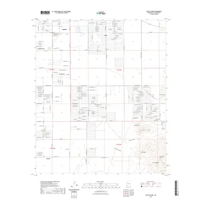
2023 Map of Capitol Dome
USGS Topo · Published 2023About this map
Deming anchors the northwestern corner of this study, where a dense grid of residential and municipal streets gives way to the more expansive rural subdivisions of Ventura, Mountain View, and La Hacienda. The landscape is defined by the sharp transition from the flat high-desert basin to the northern reaches of the Florida Mountains. This area exhibits a distinct pattern of modern land development, characterized by long, straight roadways like San Augustine Rd SE and Lagremas St that stretch toward the base of the peaks.
Find a feature on this map
144 named features on this map. Tap any name to fly to it.
Don’t see what you’re looking for? This feature index may not catch every label — zoom into the map to look around manually.
Map Details
Editions of this 2023 Capitol Dome Map
This is the sole edition of this map. No revisions or reprints were ever made.
Other maps of this area

1899 · Deming
USGS Topo · 1:125,000

1915 · Deming
USGS Topo · 1:125,000

1955 · Las Cruces
USGS Topo · 1:250,000

1958 · Las Cruces
USGS Topo · 1:250,000

1964 · Gym Peak
USGS Topo · 1:24,000

1964 · Deming West
USGS Topo · 1:24,000

1964 · Florida Gap
USGS Topo · 1:24,000

1965 · South Peak
USGS Topo · 1:24,000

1965 · Deming East
USGS Topo · 1:24,000
1965 · Midway Butte
USGS Topo · 1:24,000