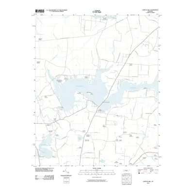
2010 Map of Capitol Hill
USGS Topo · Published 2010About this map
Woods Reservoir dominates this landscape, created by the Elk River Dam to serve the aerospace research needs of the region. The map captures a unique intersection of high-technology and rural heritage, where the University of Tennessee Space Institute stands adjacent to historical landmarks like Elder Island and the Morris Ferry Bridge. This area, once defined by the flowing Elk River, has been transformed into a significant water body supporting recreational sites like Camp Tannassie and Camp Arrowhead.
Find a feature on this map
103 named features on this map. Tap any name to fly to it.
Don’t see what you’re looking for? This feature index may not catch every label — zoom into the map to look around manually.
Map Details
Editions of this 2010 Capitol Hill Map
This is the sole edition of this map. No revisions or reprints were ever made.
Other maps of this area

1895 · Sewanee
USGS Topo · 1:125,000

1928 · Decherd
USGS Topo · 1:62,500

1936 · Ovoca
USGS Topo · 1:24,000

1936 · Sewanee
USGS Topo · 1:24,000

1936 · Alto
USGS Topo · 1:24,000

1936 · Manchester
USGS Topo · 1:24,000

1936 · Winchester
USGS Topo · 1:24,000

1936 · Hillsboro
USGS Topo · 1:24,000

1936 · Belvidere
USGS Topo · 1:24,000

1936 · Camp Peay
USGS Topo · 1:24,000