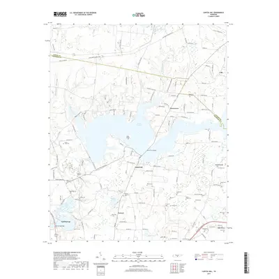
2019 Map of Capitol Hill
USGS Topo · Published 2019About this map
Woods Reservoir and the Elk River dominate this modern topographic view of the Coffee and Franklin county line. The landscape is defined by the transition from the rolling waters of the reservoir to the established communities of Estill Springs and Decherd. This area is exceptionally rich in genealogical data, preserving a high density of burial grounds that mark the heritage of family settlements. Notable sites include the Duncans Stagecoach Cem, the Old Grays Mill Cem, and New Brick Church Cem. Along the northern shores, Elder Island and Lye Pond show the complex hydrology of the region, while the Morris Ferry Bridge provides a vital link across the central waters. The map also documents local landmarks like Little Mtn and the community of Capitol Hill, tracing the intersection of mid-twentieth-century water projects with much older agrarian footprints.
Find a feature on this map
134 named features on this map. Tap any name to fly to it.
Don’t see what you’re looking for? This feature index may not catch every label — zoom into the map to look around manually.
Map Details
Editions of this 2019 Capitol Hill Map
This is the sole edition of this map. No revisions or reprints were ever made.
Other maps of this area

1895 · Sewanee
USGS Topo · 1:125,000

1928 · Decherd
USGS Topo · 1:62,500

1936 · Ovoca
USGS Topo · 1:24,000

1936 · Sewanee
USGS Topo · 1:24,000

1936 · Alto
USGS Topo · 1:24,000

1936 · Manchester
USGS Topo · 1:24,000

1936 · Winchester
USGS Topo · 1:24,000

1936 · Hillsboro
USGS Topo · 1:24,000

1936 · Belvidere
USGS Topo · 1:24,000

1936 · Camp Peay
USGS Topo · 1:24,000