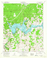
1962 Map of Capitol Hill
USGS Topo · Published 1964About this map
The Arnold Engineering Development Center U S Air Force dominates the northern half of this landscape, reflecting the military's expanding aerospace research footprint during the Cold War. Centered around the massive Woods Reservoir, which was created by the Elk River-Dam, the area is a hybrid of high-tech testing grounds and recreation. Lakeside developments like Camp Arrowhead and the AEDC Recreation Area sit alongside the high-security facilities of the base.
Find a feature on this map
49 named features on this map. Tap any name to fly to it.
Don’t see what you’re looking for? This feature index may not catch every label — zoom into the map to look around manually.
Map Details
Editions of this 1962 Capitol Hill Map
This is the sole edition of this map. No revisions or reprints were ever made.
Other maps of this area

1895 · Sewanee
USGS Topo · 1:125,000

1928 · Decherd
USGS Topo · 1:62,500

1936 · Ovoca
USGS Topo · 1:24,000

1936 · Sewanee
USGS Topo · 1:24,000

1936 · Alto
USGS Topo · 1:24,000

1936 · Manchester
USGS Topo · 1:24,000

1936 · Winchester
USGS Topo · 1:24,000

1936 · Hillsboro
USGS Topo · 1:24,000

1936 · Belvidere
USGS Topo · 1:24,000

1936 · Camp Peay
USGS Topo · 1:24,000