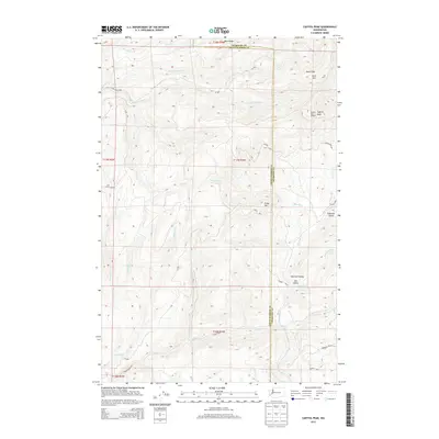
2013 Map of Capitol Peak
USGS Topo · Published 2013About this map
Capitol Peak Lookout stands as a primary high point in the Black Hills, anchoring a landscape defined by the intersection of Thurston County and Grays Harbor County. The 2013 survey of this area highlights the dense network of drainage systems feeding the Chehalis River basin, including the North Fork Porter Creek and South Fork Porter Creek. Deep valleys like Sherman Valley and Lost Valley contrast with prominent heights such as Larch Mountain, Fuzzy Top, and Buck Ridge. This topography is largely managed as the Capitol Forest, where the infrastructure is dominated by unpaved forestry access roads like Cedar Creek Road and Bordeaux Road SW. The map documents a working landscape of timber management and watershed protection as it existed in the early twenty-first century.
Find a feature on this map
37 named features on this map. Tap any name to fly to it.
Don’t see what you’re looking for? This feature index may not catch every label — zoom into the map to look around manually.
Map Details
Editions of this 2013 Capitol Peak Map
This is the sole edition of this map. No revisions or reprints were ever made.
Other maps of this area

1939 · Shelton
USGS Topo · 1:62,500

1941 · Gate
USGS Topo · 1:62,500

1941 · Ford
USGS Topo · 1:62,500

1943 · Nahwatzel Lake
USGS Topo · 1:62,500

1953 · Hoquiam
USGS Topo · 1:250,000

1953 · Rochester
USGS Topo · 1:62,500

1953 · Malone
USGS Topo · 1:62,500

1953 · Shelton
USGS Topo · 1:62,500

1953 · Elma
USGS Topo · 1:62,500

1957 · Hoquiam
USGS Topo · 1:250,000