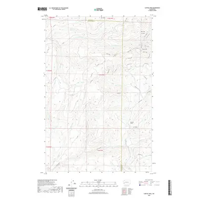
2020 Map of Capitol Peak
USGS Topo · Published 2020About this map
Capitol Peak stands as the primary topographical sentinel within the Capitol Forest, anchoring a landscape of the Black Hills that spans the border between Thurston and Grays Harbor counties. This high-country region is defined by a dense network of forest roads and trails, including the Crestline Trail and Wedekind Trail, which traverse the ridgelines between peaks like Larch Mtn and Fuzzy Top. The drainage patterns here are complex, with the headwaters of the S Fork Porter Cr and N Fork Porter Cr flowing westward, while Sherman Cr and Lost Valley Cr carve out the distinct lowlands of Sherman Valley and Lost Valley to the southeast. The map reveals an active working forest environment where legacy logging routes like B-Line Rd and C-Line Road provide the framework for contemporary recreational and resource management access.
Find a feature on this map
52 named features on this map. Tap any name to fly to it.
Don’t see what you’re looking for? This feature index may not catch every label — zoom into the map to look around manually.
Map Details
Editions of this 2020 Capitol Peak Map
This is the sole edition of this map. No revisions or reprints were ever made.
Other maps of this area

1939 · Shelton
USGS Topo · 1:62,500

1941 · Gate
USGS Topo · 1:62,500

1941 · Ford
USGS Topo · 1:62,500

1943 · Nahwatzel Lake
USGS Topo · 1:62,500

1953 · Hoquiam
USGS Topo · 1:250,000

1953 · Rochester
USGS Topo · 1:62,500

1953 · Malone
USGS Topo · 1:62,500

1953 · Shelton
USGS Topo · 1:62,500

1953 · Elma
USGS Topo · 1:62,500

1957 · Hoquiam
USGS Topo · 1:250,000