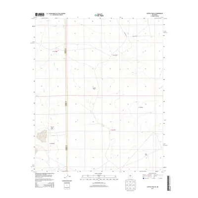
2013 Map of Capitol Peak SE
USGS Topo · Published 2013About this map
Salina de San Andres dominates the western portion of this terrain, a significant salt flat at the foot of the mountains in the Tularosa Valley. The landscape is characterized by sparse water sources and distinct geological formations, including the dark basalt flows of The Malpais to the east and the shifting environment of The Sands further south. This 2013 survey captures the area within the White Sands Missile Range, reflected in the presence of restricted access roads such as WSMR P Route 23 and WSMR S Route 314.
Find a feature on this map
14 named features on this map. Tap any name to fly to it.
Don’t see what you’re looking for? This feature index may not catch every label — zoom into the map to look around manually.
Map Details
Editions of this 2013 Capitol Peak SE Map
This is the sole edition of this map. No revisions or reprints were ever made.
Other maps of this area

1916 · Tularosa
USGS Topo · 1:125,000

1947 · Three Rivers
USGS Topo · 1:62,500

1947 · Capitol Peak
USGS Topo · 1:62,500

1948 · Lumley Lake
USGS Topo · 1:62,500

1948 · Tularosa
USGS Topo · 1:62,500

1954 · Tularosa
USGS Topo · 1:250,000

1958 · Tularosa
USGS Topo · 1:250,000

1981 · Tularosa
USGS Topo · 1:100,000
1981 · Three Rivers SW
USGS Topo · 1:24,000
1981 · Sheep Mountain
USGS Topo · 1:24,000