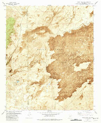
1981 Map of Capitol Peak SE
USGS Topo · Published 1982About this map
White Sands Missile Range dominates this landscape, where the rugged volcanic flows of The Malpais meet the arid basins of Otero and Sierra Counties. This orthophotomap, based on 1971 aerial photography, provides a rare visual of the stark geomorphology of the Tularosa Basin during the late twentieth century. In the western reaches, Salt Creek and Salt Springs mark the drainage patterns, while the unique Salina de San Andres provides a distinct hydrological landmark. The map identifies specific infrastructure like Lower Well and Short Well, as well as the Malpais Site near the southern lava edge, suggesting a history of rangeland management and exploration within the bounds of the military reservation. The proximity of Malpais Spring to the dark, textured basalt fields illustrates the relationship between water sources and the forbidding terrain of the lava beds.
Find a feature on this map
14 named features on this map. Tap any name to fly to it.
Don’t see what you’re looking for? This feature index may not catch every label — zoom into the map to look around manually.
Map Details
Editions of this 1981 Capitol Peak SE Map
This is the sole edition of this map. No revisions or reprints were ever made.
Other maps of this area

1916 · Tularosa
USGS Topo · 1:125,000

1947 · Three Rivers
USGS Topo · 1:62,500

1947 · Capitol Peak
USGS Topo · 1:62,500

1948 · Lumley Lake
USGS Topo · 1:62,500

1948 · Tularosa
USGS Topo · 1:62,500

1954 · Tularosa
USGS Topo · 1:250,000

1958 · Tularosa
USGS Topo · 1:250,000

1981 · Tularosa
USGS Topo · 1:100,000
1981 · Three Rivers SW
USGS Topo · 1:24,000
1981 · Sheep Mountain
USGS Topo · 1:24,000