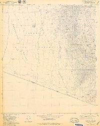
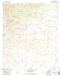
1979 Map of Caponera Peak
USGS Topo · Published 1979About this map
The Papago Indian Reservation occupies much of this landscape, where the flat floor of the Baboquivari Valley meets the rising elevations of the Baboquivari Mountains. This 1970s survey captures a borderland environment defined by its water-management features, including numerous named tanks such as Papago Tank and Caponera Tank which sustained local life and livestock. The settlement pattern is sparse, indicated by locations like Newfield and the Ruins near Buenos Aires.
Find a feature on this map
27 named features on this map. Tap any name to fly to it.
Don’t see what you’re looking for? This feature index may not catch every label — zoom into the map to look around manually.
Map Details
Editions of this 1979 Caponera Peak Map
3 editions found
Other maps of this area

1941 · Presumido Peak
USGS Topo · 1:62,500

1941 · Vamori
USGS Topo · 1:62,500

1943 · Fresnal
USGS Topo · 1:125,000

1943 · Presumido Peak
USGS Topo · 1:62,500

1943 · Vamori
USGS Topo · 1:62,500

1956 · Nogales
USGS Topo · 1:250,000

1958 · Nogales
USGS Topo · 1:250,000

1959 · Nogales
USGS Topo · 1:250,000
1979 · Sasabe
USGS Topo · 1:24,000
1979 · Mildred Peak
USGS Topo · 1:24,000
Featured Places
- Chukut Kuk District, AZ
- Newfield, Chukut Kuk District
- Buenos Aires, Chukut Kuk District
- Sapano Vaya, Chukut Kuk District
- Kom Kug, Chukut Kuk District