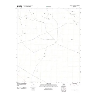
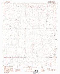
2010 Map of Caprock Mountain
USGS Topo · Published 2010About this map
Constellation Mine, Poe Mine, and Cliff Roy Mine cluster near the northern reaches of this New Mexico landscape, reflecting the region's enduring mining heritage. The terrain is defined by dramatic elevations and drainage patterns, from the heights of Caprock Mountain and Lone Mountain to the sprawling Mesa Lordsburg in the southwest. A network of essential water sources and landmarks supports the ranching life here, including the Fuller Ranch and several functional points like the Harper Windmill and Box Canyon Windmill.
Find a feature on this map
22 named features on this map. Tap any name to fly to it.
Don’t see what you’re looking for? This feature index may not catch every label — zoom into the map to look around manually.
Map Details
Editions of this 2010 Caprock Mountain Map
This is the sole edition of this map. No revisions or reprints were ever made.
Other maps of this area

1954 · Silver City
USGS Topo · 1:250,000

1958 · Silver City
USGS Topo · 1:250,000

1959 · Redrock
USGS Topo · 1:62,500

1959 · Canador Peak
USGS Topo · 1:62,500

1962 · Silver City
USGS Topo · 1:250,000

1963 · Culberson Ranch
USGS Topo · 1:24,000
1964 · Summit
USGS Topo · 1:24,000
1964 · Ninemile Hill
USGS Topo · 1:24,000
1981 · Lordsburg
USGS Topo · 1:100,000
1990 · Willow Draw
USGS Topo · 1:24,000