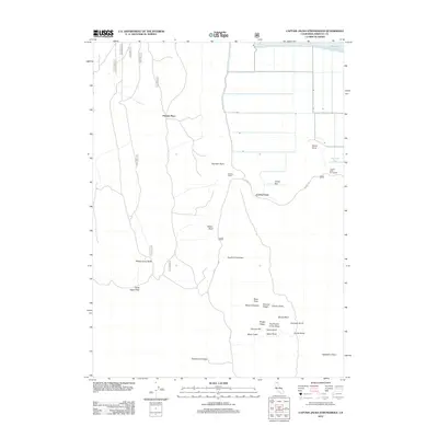
2012 Map of Captain Jacks Stronghold
USGS Topo · Published 2012About this map
Captain Jacks Stronghold and the surrounding volcanic landscape of Northern California define this modern survey of the Modoc Plateau. The map provides a contemporary record of significant cultural and historical sites, including Gillems Camp and Canby Cross, situated near the southern edge of Tule Lake. The terrain is marked by distinctive geological formations such as the Schonchin Flow, Ross Flow, and the appropriately named Devils Homestead. Local history researchers will find several family-named landmarks and historical sites documented, from the Fleener Place to the jagged elevations of Gillem Bluff and Sheep Camp Butte. The presence of features like Gold Digge Pass and Ross Chimneys highlights the unique topography and frontier legacy of this portion of Siskiyou County.
Find a feature on this map
34 named features on this map. Tap any name to fly to it.
Don’t see what you’re looking for? This feature index may not catch every label — zoom into the map to look around manually.
Map Details
Editions of this 2012 Captain Jacks Stronghold Map
This is the sole edition of this map. No revisions or reprints were ever made.
Other maps of this area

1886 · Modoc Lava Bed
USGS Topo · 1:250,000

1892 · Modoc Lava-Bed
USGS Topo · 1:250,000

1950 · Mt. Dome
USGS Topo · 1:62,500

1951 · Tulelake
USGS Topo · 1:62,500

1952 · Timber Mountain
USGS Topo · 1:62,500

1952 · Medicine Lake
USGS Topo · 1:62,500

1954 · Alturas
USGS Topo · 1:250,000

1958 · Alturas
USGS Topo · 1:250,000

1962 · Alturas
USGS Topo · 1:250,000

1965 · Alturas
USGS Topo · 1:250,000