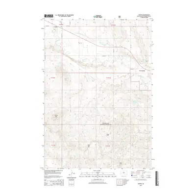
2015 Map of Caputa
USGS Topo · Published 2015About this map
Rapid Creek defines the local hydrology of this Pennington County landscape, flanked by the irrigation infrastructure of the Saint Germaine Ditch. The small settlement of Caputa sits in the northwest corner, while Farmingdale is positioned further east along the waterway. The map reveals an area where high-plains agriculture and open ranch land meet, notably within the boundaries of the Buffalo Gap National Grassland.
Find a feature on this map
28 named features on this map. Tap any name to fly to it.
Don’t see what you’re looking for? This feature index may not catch every label — zoom into the map to look around manually.
Map Details
Editions of this 2015 Caputa Map
This is the sole edition of this map. No revisions or reprints were ever made.
Other maps of this area

1893 · Rapid
USGS Topo · 1:125,000

1894 · Hermosa
USGS Topo · 1:125,000

1898 · Rapid
USGS Topo · 1:125,000

1901 · Hermosa
USGS Topo · 1:125,000

1903 · Rapid
USGS Topo · 1:125,000

1953 · Boxelder
USGS Topo · 1:24,000

1953 · New Underwood
USGS Topo · 1:24,000

1953 · New Underwood SW
USGS Topo · 1:24,000

1953 · Caputa
USGS Topo · 1:24,000

1953 · Hermosa SE
USGS Topo · 1:24,000