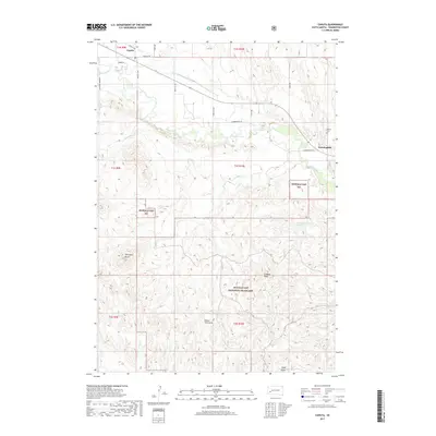
2017 Map of Caputa
USGS Topo · Published 2017About this map
Rapid Creek defines the northern landscape of this Pennington County region, flowing eastward past the small settlements of Caputa and Farmingdale. The agricultural history of the area is etched into the terrain via the Saint Germaine Ditch, a water management feature that parallels the creek. To the south, the landscape shifts into the expansive reaches of the Buffalo Gap National Grassland, where the terrain is marked by significant draws including Lindsey Draw, Indian Trail Draw, and Hibbs Draw. This survey illustrates the contrast between the fertile creek bottom and the high, broken ground of Thompson Butte. Local history is anchored by the Larsen Cem north of Farmingdale, while local transportation routes like Hammerquist Rd and Antelope Creek Rd provide a clear view of how these prairie communities remained connected through the early twenty-first century.
Find a feature on this map
27 named features on this map. Tap any name to fly to it.
Don’t see what you’re looking for? This feature index may not catch every label — zoom into the map to look around manually.
Map Details
Editions of this 2017 Caputa Map
This is the sole edition of this map. No revisions or reprints were ever made.
Other maps of this area

1893 · Rapid
USGS Topo · 1:125,000

1894 · Hermosa
USGS Topo · 1:125,000

1898 · Rapid
USGS Topo · 1:125,000

1901 · Hermosa
USGS Topo · 1:125,000

1903 · Rapid
USGS Topo · 1:125,000

1953 · Boxelder
USGS Topo · 1:24,000

1953 · New Underwood
USGS Topo · 1:24,000

1953 · New Underwood SW
USGS Topo · 1:24,000

1953 · Caputa
USGS Topo · 1:24,000

1953 · Hermosa SE
USGS Topo · 1:24,000