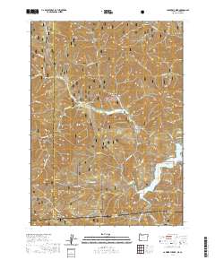
2020 Map of Carberry Creek
USGS Topo · Published 2020About this map
The Rogue River National Forest defines this high-elevation region along the border of Oregon and California, where the southern reaches of Jackson County meet the Siskiyou Mountains. The settlement of Steamboat and the nearby Steamboat Cem sit along the Carberry Cr drainage, a tributary system that feeds the significant Applegate Lake reservoir at the southern end of the map. This area is characterized by steep ridges and deep gulches, such as Bailey Gulch and Sawmill Gulch, which illustrate the complex drainage patterns into the Applegate River. Historically significant for its transit and timber potential, the terrain rises sharply to landmarks like Steamboat Mtn and Billy Mtn. Smaller geographic markers like Baker Flat and the community of Copper indicate the sparse but persistent human footprint in this mountainous borderland.
Find a feature on this map
69 named features on this map. Tap any name to fly to it.
Don’t see what you’re looking for? This feature index may not catch every label — zoom into the map to look around manually.
Map Details
Editions of this 2020 Carberry Creek Map
This is the sole edition of this map. No revisions or reprints were ever made.
Other maps of this area

1908 · Grants Pass
USGS Topo · 1:125,000

1914 · Seiad
USGS Topo · 1:125,000

1922 · Seiad
USGS Topo · 1:125,000

1948 · Weed
USGS Topo · 1:250,000

1950 · Weed
USGS Topo · 1:250,000

1954 · Oregon Caves
USGS Topo · 1:62,500

1954 · Ruch
USGS Topo · 1:62,500

1955 · Seiad Valley
USGS Topo · 1:62,500

1955 · Medford
USGS Topo · 1:250,000

1956 · Happy Camp
USGS Topo · 1:62,500