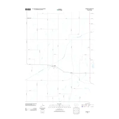
2013 Map of Carbon
USGS Topo · Published 2013About this map
Carbon sits at the junction of Bull Cr and the Middle Nodaway River, serving as a focal point in this section of Adams County. The settlement pattern follows a grid of local roads like Elm Ave and Filbert Ave, which connect the rural landscape to smaller hubs such as Quincy and Lincoln Center. The geography is defined by the winding paths of Show Cr and Kemp Cr, which feed into the larger river system. To the east, the edge of Lake Icaria appears near Lake Icaria RD, indicating the transition from river-bottom land to larger recreational water bodies. This area reflects a long-standing agricultural tradition, with numerous farm-to-market roads like 190th ST and Chestnut Ave providing the infrastructure for the local economy in the early 21st century.
Find a feature on this map
42 named features on this map. Tap any name to fly to it.
Don’t see what you’re looking for? This feature index may not catch every label — zoom into the map to look around manually.
Map Details
Editions of this 2013 Carbon Map
This is the sole edition of this map. No revisions or reprints were ever made.
Other maps of this area

1954 · Omaha
USGS Topo · 1:250,000

1955 · Nebraska City
USGS Topo · 1:250,000

1957 · Nebraska City
USGS Topo · 1:250,000

1957 · Omaha
USGS Topo · 1:250,000

1958 · Omaha
USGS Topo · 1:250,000

1958 · Nebraska City
USGS Topo · 1:250,000

1980 · Corning South
USGS Topo · 1:24,000

1980 · Corning North
USGS Topo · 1:24,000

1980 · Grant
USGS Topo · 1:24,000
1980 · Brooks
USGS Topo · 1:24,000