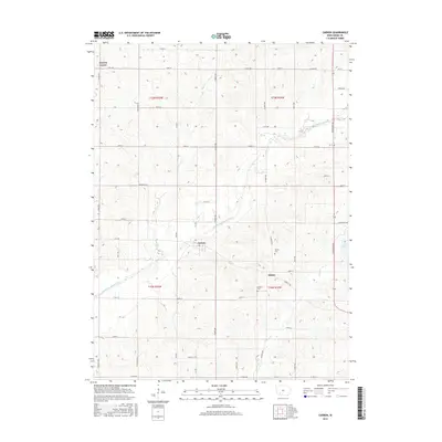
2015 Map of Carbon
USGS Topo · Published 2015About this map
Carbon sits along the Middle Nodaway River in this western Iowa landscape, where the river's winding course defines the township's agricultural layout. This region of Adams County is characterized by a dense grid of rural routes such as Ironwood Ave and Co Rd H20, supporting the dispersed settlements of Quincy and Lincoln Center. The map reveals the local history through its burial grounds, including the Quincy Cem and Oakland Cem, which serve as permanent records of the area's early residents. The topography is shaped by several tributaries, notably Snow Cr, Bull Cr, and Kemp Cr, which feed into the primary river valley. To the east, the edge of Lake Icaria indicates a transition toward managed water resources and recreation, while the surveyor's grid remains the primary organizing force for the farms and homesteads across t73n r35w and surrounding townships.
Find a feature on this map
47 named features on this map. Tap any name to fly to it.
Don’t see what you’re looking for? This feature index may not catch every label — zoom into the map to look around manually.
Map Details
Editions of this 2015 Carbon Map
This is the sole edition of this map. No revisions or reprints were ever made.
Other maps of this area

1954 · Omaha
USGS Topo · 1:250,000

1955 · Nebraska City
USGS Topo · 1:250,000

1957 · Nebraska City
USGS Topo · 1:250,000

1957 · Omaha
USGS Topo · 1:250,000

1958 · Omaha
USGS Topo · 1:250,000

1958 · Nebraska City
USGS Topo · 1:250,000

1980 · Corning South
USGS Topo · 1:24,000

1980 · Corning North
USGS Topo · 1:24,000

1980 · Grant
USGS Topo · 1:24,000
1980 · Brooks
USGS Topo · 1:24,000