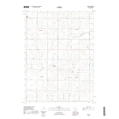
2018 Map of Carbon
USGS Topo · Published 2018About this map
Carbon and Quincy anchor this section of Adams County, where the agricultural landscape is deeply etched by the meandering Middle Nodaway River. The town of Quincy, once a prominent local center, is documented here alongside its historic Quincy Cem and nearby Oakland Cem. The terrain is defined by a dense network of drainages, including Bull Cr, Show Cr, and Kemp Cr, which feed into the river system. To the northeast, the recreational waters of Lake Icaria offer a distinct contrast to the surrounding grid of county roads like Co RD h20 and Co RD h34. This survey illustrates the persistent rural structure of the region, where small settlements like Lincoln Center remain connected by an extensive section-line road network such as Dogwood Ave and Ironwood Ave.
Find a feature on this map
42 named features on this map. Tap any name to fly to it.
Don’t see what you’re looking for? This feature index may not catch every label — zoom into the map to look around manually.
Map Details
Editions of this 2018 Carbon Map
This is the sole edition of this map. No revisions or reprints were ever made.
Other maps of this area

1954 · Omaha
USGS Topo · 1:250,000

1955 · Nebraska City
USGS Topo · 1:250,000

1957 · Nebraska City
USGS Topo · 1:250,000

1957 · Omaha
USGS Topo · 1:250,000

1958 · Omaha
USGS Topo · 1:250,000

1958 · Nebraska City
USGS Topo · 1:250,000

1980 · Corning South
USGS Topo · 1:24,000

1980 · Corning North
USGS Topo · 1:24,000

1980 · Grant
USGS Topo · 1:24,000
1980 · Brooks
USGS Topo · 1:24,000