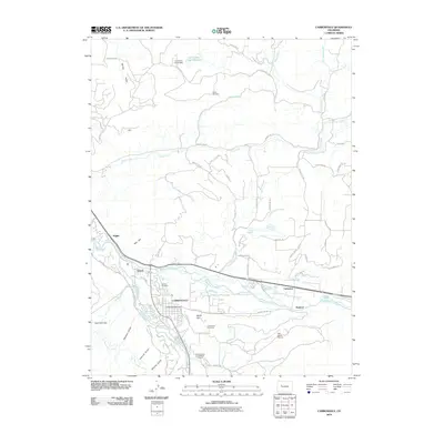
2010 Map of Carbondale
USGS Topo · Published 2010About this map
Carbondale serves as the central hub of this Garfield County landscape, situated at the confluence of the Roaring Fork River and the Crystal River. The town's organization is anchored by the Carbondale Post Office and surrounded by numerous named hills and gulches, including Red Hill and White Hill. Water management is central to the area's development, evidenced by an extensive network of irrigation features such as Town Ditch, Rockford Ditch, and East Mesa Ditch, alongside the Van Cleve-Fisher Dam to the north. For genealogists and local historians, the map identifies three distinct burial sites: Weaver Cemetery, Carbondale Cemetery, and Fisher Cemetery. The industrial footprint includes the Midcontinent Limestone Quarry, while transportation is represented by the Glen-Aspen Airport and outlying settlements like Kiggin, Mulford, and Catherine.
Find a feature on this map
71 named features on this map. Tap any name to fly to it.
Don’t see what you’re looking for? This feature index may not catch every label — zoom into the map to look around manually.
Map Details
Editions of this 2010 Carbondale Map
This is the sole edition of this map. No revisions or reprints were ever made.
Other maps of this area

1927 · Glenwood Springs
USGS Topo · 1:125,000

1930 · Glenwood Springs
USGS Topo · 1:125,000

1957 · Leadville
USGS Topo · 1:250,000

1959 · Leadville
USGS Topo · 1:250,000

1960 · Leadville
USGS Topo · 1:250,000

1961 · Mount Sopris
USGS Topo · 1:24,000

1961 · Cattle Creek
USGS Topo · 1:24,000

1961 · Carbondale
USGS Topo · 1:24,000

1961 · Leon
USGS Topo · 1:24,000

1961 · Basalt
USGS Topo · 1:24,000