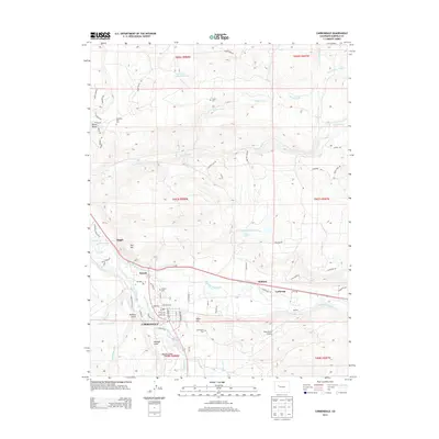
2013 Map of Carbondale
USGS Topo · Published 2013About this map
Carbondale and the surrounding Garfield County landscape are defined by the confluence of the Roaring Fork River and the Crystal River. In this early 21st-century documentation, the valley floor shows a complex network of agricultural and municipal water management, including the Sweet Jessup Canal, Rockford Ditch, and Glenwood Ditch, which support the pastures and ranchlands climbing toward Red Hill. The residential development of Carbondale is contrasted by smaller outlying settlements like Satank and Catherine. For those researching local families, several burial grounds are clearly marked, including Weaver Cem, Fisher Cem, and Carbondale Cem. The presence of the Glen-Aspen Airport and various gulches like Holland Gulch and Barbers Gulch illustrate the varied topography between the river basin and the rising foothills of the Elk Mountains.
Find a feature on this map
74 named features on this map. Tap any name to fly to it.
Don’t see what you’re looking for? This feature index may not catch every label — zoom into the map to look around manually.
Map Details
Editions of this 2013 Carbondale Map
This is the sole edition of this map. No revisions or reprints were ever made.
Other maps of this area

1927 · Glenwood Springs
USGS Topo · 1:125,000

1930 · Glenwood Springs
USGS Topo · 1:125,000

1957 · Leadville
USGS Topo · 1:250,000

1959 · Leadville
USGS Topo · 1:250,000

1960 · Leadville
USGS Topo · 1:250,000

1961 · Mount Sopris
USGS Topo · 1:24,000

1961 · Cattle Creek
USGS Topo · 1:24,000

1961 · Carbondale
USGS Topo · 1:24,000

1961 · Leon
USGS Topo · 1:24,000

1961 · Basalt
USGS Topo · 1:24,000