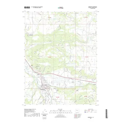
2019 Map of Carbondale
USGS Topo · Published 2019About this map
Carbondale sits at the significant confluence of the Roaring Fork River and the Crystal River, serving as a central hub for the surrounding valley. This 2019 survey illustrates a landscape defined by its irrigation and transportation networks, featuring numerous water management systems like the Rockford Ditch, Sweet Jessup Canal, and E Mesa Ditch. These systems support the agricultural reaches between smaller settlements such as Satank, Mulford, and Catherine.
Find a feature on this map
129 named features on this map. Tap any name to fly to it.
Don’t see what you’re looking for? This feature index may not catch every label — zoom into the map to look around manually.
Map Details
Editions of this 2019 Carbondale Map
This is the sole edition of this map. No revisions or reprints were ever made.
Other maps of this area

1927 · Glenwood Springs
USGS Topo · 1:125,000

1930 · Glenwood Springs
USGS Topo · 1:125,000

1957 · Leadville
USGS Topo · 1:250,000

1959 · Leadville
USGS Topo · 1:250,000

1960 · Leadville
USGS Topo · 1:250,000

1961 · Mount Sopris
USGS Topo · 1:24,000

1961 · Cattle Creek
USGS Topo · 1:24,000

1961 · Carbondale
USGS Topo · 1:24,000

1961 · Leon
USGS Topo · 1:24,000

1961 · Basalt
USGS Topo · 1:24,000