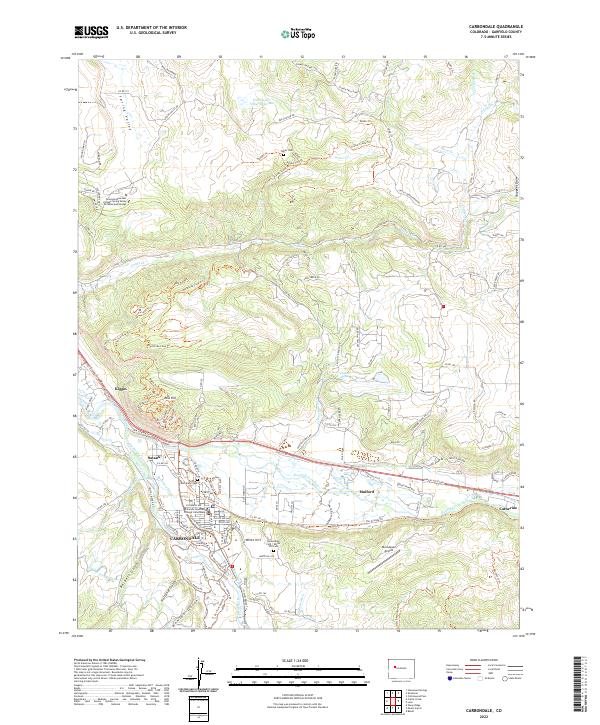
2022 Map of Carbondale
USGS Topo · Published 2022About this map
The Carbondale valley floor is a complex network of agricultural and municipal water management where the Crystal River joins the Roaring Fork River. This 2022 survey details the extensive irrigation infrastructure supporting the region, including the Kaiser-Sievers Ditch, Rockford Ditch, and Sweet Jessup Canal. The landscape is marked by historic burial grounds like Evergreen Cem and the Carbondale Cem - White Hill Cem, while the northern uplands around Red Hill are defined by an intricate system of recreation paths like the Northside Loop Trl and Elk Traverse Trl. Settlements such as Satank, Mulford, and Catherine dot the river corridors, reflecting the area's transition from traditional ranching roots to a modern educational and residential hub anchored by Colorado Mountain College Carbondale.
Find a feature on this map
137 named features on this map. Tap any name to fly to it.
Don’t see what you’re looking for? This feature index may not catch every label — zoom into the map to look around manually.
Map Details
Editions of this 2022 Carbondale Map
This is the sole edition of this map. No revisions or reprints were ever made.
Other maps of this area

1927 · Glenwood Springs
USGS Topo · 1:125,000

1930 · Glenwood Springs
USGS Topo · 1:125,000

1957 · Leadville
USGS Topo · 1:250,000

1959 · Leadville
USGS Topo · 1:250,000

1960 · Leadville
USGS Topo · 1:250,000

1961 · Mount Sopris
USGS Topo · 1:24,000

1961 · Cattle Creek
USGS Topo · 1:24,000

1961 · Carbondale
USGS Topo · 1:24,000

1961 · Leon
USGS Topo · 1:24,000

1961 · Basalt
USGS Topo · 1:24,000