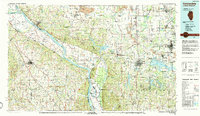
1986 Map of Carbondale
USGS Topo · Published 1986About this map
The Mississippi River defines the western edge of this 1980s landscape, winding past Kaskaskia Island and the riverside community of Chester. Inland, the region is characterized by a dense network of water bodies and conservation areas, including the expansive Crab Orchard National Wildlife Refuge and the rugged Shawnee National Forest. The map captures the prominence of Southern Illinois University in the east, while the northern sections show the industrial footprint of Strip Mines near Du Quoin.
Find a feature on this map
149 named features on this map. Tap any name to fly to it.
Don’t see what you’re looking for? This feature index may not catch every label — zoom into the map to look around manually.
Map Details
Editions of this 1986 Carbondale Map
This is the sole edition of this map. No revisions or reprints were ever made.
Other maps of this area

1907 · Weingarten
USGS Topo · 1:62,500

1909 · Weingarten
USGS Topo · 1:62,500

1909 · West Frankfort
USGS Topo · 1:62,500

1910 · Herrin
USGS Topo · 1:62,500

1910 · Higdon
USGS Topo · 1:62,500

1910 · Murphysboro
USGS Topo · 1:62,500

1912 · Baldwin
USGS Topo · 1:62,500

1914 · Baldwin
USGS Topo · 1:62,500

1914 · Coulterville
USGS Topo · 1:62,500

1915 · Renault
USGS Topo · 1:62,500