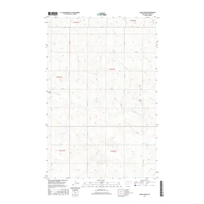
2017 Map of Carda Coulee
USGS Topo · Published 2017About this map
Carda Coulee defines the drainage patterns of this eastern Montana landscape, where the headwaters of several key creeks converge. The terrain is marked by the presence of Latka Reservoir and the prominent height of Flag Butte, reflecting a region tied to water management and ranching. A network of county roads, including Co RD 318 and Co RD 321, provides the primary infrastructure through the section lines of the Public Land Survey System. The map documents the intricate hydrography of the area, featuring the winding paths of W Charlie Cr and the N Fork E Redwater Cr. These drainages, alongside the E Fork Fox Cr and Middle Fork Fox Cr, illustrate the complex watershed that shapes the local topography in Richland County.
Find a feature on this map
19 named features on this map. Tap any name to fly to it.
Don’t see what you’re looking for? This feature index may not catch every label — zoom into the map to look around manually.
Map Details
Editions of this 2017 Carda Coulee Map
This is the sole edition of this map. No revisions or reprints were ever made.
Other maps of this area

1909 · Glendive
USGS Topo · 1:250,000

1954 · Glendive
USGS Topo · 1:250,000

1957 · Glendive
USGS Topo · 1:250,000

1958 · Glendive
USGS Topo · 1:250,000

1972 · Fox Lake
USGS Topo · 1:24,000

1972 · Kuester Lake
USGS Topo · 1:24,000

1972 · Enid
USGS Topo · 1:24,000

1981 · Sidney
USGS Topo · 1:100,000
1983 · Elmdale
USGS Topo · 1:24,000
1983 · Carda Coulee
USGS Topo · 1:24,000