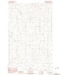
1983 Map of Elmdale
USGS Topo · Published 1983About this map
Elmdale serves as the primary focal point of this eastern Montana landscape, situated near the intersection of several notable drainage systems. The settlement is anchored by local amenities including a Cem and a Baseball Diamond, reflecting the social and community structure of this rural pocket in Richland County during the late 1970s. The terrain is defined by the branching paths of West Charlie Creek, Middle Charlie Creek, and Shack Creek, which carve through the high plains before leading toward the Big Basin Coulee. Agricultural and industrial markers are sparse but significant, with Grain Bins and Gravel Pits indicating the local reliance on ranching and earthwork. This provisional survey captures the area just before the mid-1980s, preserving a record of the homesteads and infrastructure that sustained this remote community.
Find a feature on this map
10 named features on this map. Tap any name to fly to it.
Don’t see what you’re looking for? This feature index may not catch every label — zoom into the map to look around manually.
Map Details
Editions of this 1983 Elmdale Map
This is the sole edition of this map. No revisions or reprints were ever made.
Other maps of this area

1909 · Glendive
USGS Topo · 1:250,000

1914 · Brockton
USGS Topo · 1:62,500

1954 · Glendive
USGS Topo · 1:250,000

1954 · Wolf Point
USGS Topo · 1:250,000

1957 · Glendive
USGS Topo · 1:250,000

1958 · Wolf Point
USGS Topo · 1:250,000

1958 · Glendive
USGS Topo · 1:250,000
1969 · Twomile Creek
USGS Topo · 1:24,000
1972 · Frog Coulee
USGS Topo · 1:24,000
1972 · Mortarstone Bluff
USGS Topo · 1:24,000