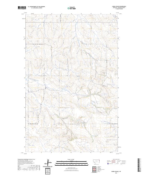
2024 Map of Carda Coulee
USGS Topo · Published 2024About this map
Carda Coulee carves through this portion of Richland County, defining a landscape of complex drainage systems and isolated high points. The map documents a contemporary network of county roads, including Co RD 319 and Co RD 321, which navigate the various forks and coulees typical of this Montana region. Latka Reservoir serves as a central water feature, catching runoff between the divides of North Fork East Redwater Creek and other seasonal drainages. Notable topographic landmarks such as Flag Butte rise above the surrounding terrain, providing clear orientation points in a territory where water management and ranch access are dictated by the underlying coulee structure. The presence of multiple forks, including East Fork Fox Creek and Middle Fork Fox Creek, illustrates the intricate headwater patterns that feed into the larger regional basins.
Find a feature on this map
19 named features on this map. Tap any name to fly to it.
Don’t see what you’re looking for? This feature index may not catch every label — zoom into the map to look around manually.
Map Details
Editions of this 2024 Carda Coulee Map
This is the sole edition of this map. No revisions or reprints were ever made.
Other maps of this area

1909 · Glendive
USGS Topo · 1:250,000

1954 · Glendive
USGS Topo · 1:250,000

1957 · Glendive
USGS Topo · 1:250,000

1958 · Glendive
USGS Topo · 1:250,000

1972 · Fox Lake
USGS Topo · 1:24,000

1972 · Kuester Lake
USGS Topo · 1:24,000

1972 · Enid
USGS Topo · 1:24,000

1981 · Sidney
USGS Topo · 1:100,000
1983 · Elmdale
USGS Topo · 1:24,000
1983 · Carda Coulee
USGS Topo · 1:24,000