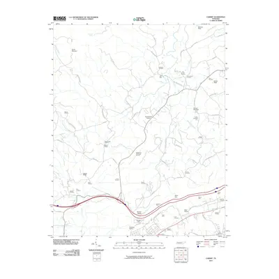
2010 Map of Cardiff
USGS Topo · Published 2010About this map
Mining operations and family burial grounds dot the transitional terrain where the Cumberland Plateau meets the Tennessee Valley. This landscape is defined by its industrial heritage, specifically the string of coal and iron resources along the base of the ridge including the Cardiff Mine, Rockwood Mine, Warner Mine, and Patton Mine. These sites sit near narrow gaps and hollows like Eblen Gap and Shahan Hollow, which historically served as corridors for transport and settlement between the elevated plateau and the lower valleys.
Find a feature on this map
73 named features on this map. Tap any name to fly to it.
Don’t see what you’re looking for? This feature index may not catch every label — zoom into the map to look around manually.
Map Details
Editions of this 2010 Cardiff Map
This is the sole edition of this map. No revisions or reprints were ever made.
Other maps of this area

1887 · Kingston
USGS Topo · 1:125,000

1891 · Kingston
USGS Topo · 1:125,000

1893 · Kingston
USGS Topo · 1:125,000

1895 · Wartburg
USGS Topo · 1:125,000

1896 · Wartburg
USGS Topo · 1:125,000

1935 · Rockwood
USGS Topo · 1:24,000

1935 · Camp Austin
USGS Topo · 1:24,000

1935 · Harriman
USGS Topo · 1:24,000

1935 · Lancing
USGS Topo · 1:24,000

1936 · Hebbertsburg
USGS Topo · 1:24,000