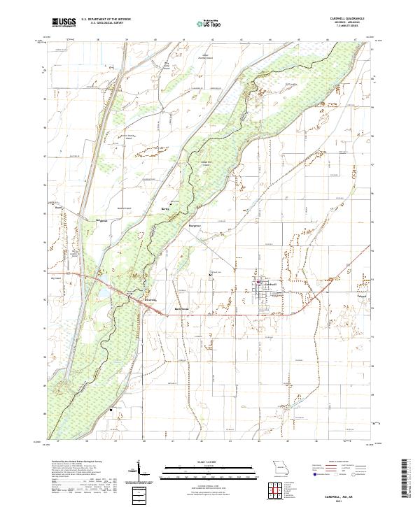
2021 Map of Cardwell
USGS Topo · Published 2021About this map
The Saint Francis River snakes along the Arkansas and Missouri border in this modern survey, defining a landscape of low-lying islands and intricate drainage networks. The city of Cardwell serves as the primary hub, showing a detailed street grid including Main St and Poole St, situated just west of Arbyrd. The surrounding bottomlands are heavily modified by engineering, with the Red Devil Ditch, Mud Slough Ditch, and Mayo Ditch redirecting water around numerous named landforms like Indian Hill Island and Boland Island. Local history is preserved through several rural burial grounds such as Cardwell Cem and Cockrum Cem. The map also captures specialized transport and infrastructure, from the Hog Air Aviation Inc Airport near Brighton to the Hopkins Bridge crossing the river south of Riverside.
Find a feature on this map
85 named features on this map. Tap any name to fly to it.
Don’t see what you’re looking for? This feature index may not catch every label — zoom into the map to look around manually.
Map Details
Editions of this 2021 Cardwell Map
This is the sole edition of this map. No revisions or reprints were ever made.
Other maps of this area

1934 · Kennett
USGS Topo · 1:62,500

1940 · Marmaduke
USGS Topo · 1:62,500

1940 · Kennett
USGS Topo · 1:62,500

1941 · Leachville
USGS Topo · 1:62,500

1941 · Manila
USGS Topo · 1:62,500

1953 · Memphis
USGS Topo · 1:250,000

1956 · Leachville
USGS Topo · 1:62,500

1956 · Kennett
USGS Topo · 1:62,500

1956 · Manila
USGS Topo · 1:62,500

1956 · Memphis
USGS Topo · 1:250,000