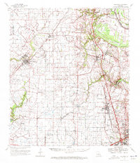
1970 Map of Carencro
USGS Topo · Published 1972About this map
The low-lying Acadiana landscape at the start of the 1970s is defined by a dense network of coulees and bayous, including the historic Bayou Teche and Bayou Carencro. This area, spanning the borders of Acadia, St. Landry, and Lafayette Parishes, is characterized by a mix of established Cajun settlements and an extensive subterranean economy of energy extraction. Major oil and gas fields, such as the Shuteston Oil and Gas Field and North Cankton Oil and Gas Field, are interspersed with community landmarks like Grand Coteau and Church Point. Local history is anchored by rural institutions such as the Christ the King Sch and numerous cemeteries including Mt Pleasant Ch Cem and Mt Calvary Cem. The transportation infrastructure relies on the established routes of the Southern Pacific and Texas and Pacific railroads, which helped facilitate the region's agricultural and industrial growth.
Find a feature on this map
59 named features on this map. Tap any name to fly to it.
Don’t see what you’re looking for? This feature index may not catch every label — zoom into the map to look around manually.
Map Details
Editions of this 1970 Carencro Map
This is the sole edition of this map. No revisions or reprints were ever made.
Other maps of this area

1934 · Duson
USGS Topo · 1:31,680

1935 · Branch
USGS Topo · 1:31,680

1939 · Opelousas
USGS Topo · 1:62,500

1939 · St. Martinsville
USGS Topo · 1:62,500

1940 · Arnaudville
USGS Topo · 1:62,500

1946 · Lafayette
USGS Topo · 1:31,680

1946 · Rayne
USGS Topo · 1:31,680

1947 · Branch
USGS Topo · 1:31,680

1947 · Chataignier
USGS Topo · 1:31,680

1947 · Pitreville
USGS Topo · 1:31,680