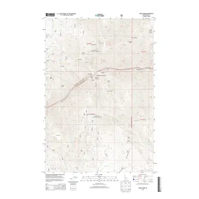
2013 Map of Carey Dome
USGS Topo · Published 2013About this map
Wind River carves a deep path through the center of this terrain, marking the boundary between the Nez Perce National Forest to the north and the Payette National Forest to the south. This remote backcountry landscape is defined by its verticality, with high points like Black Butte and its Black Butte Lookout providing vantage points over the river canyon. Local transport is limited to rugged tracks and river-access points, including the Wind River Pack Bridge and a Cable Car Crossing near Turner and Green. Settlement is sparse, represented only by isolated outposts such as McMeekin Ranch and the Hackett Cabin. Along the water, the Vinegar Creek Boat Ramp serves as a gateway to the Vinegar Creek Rapids and Chittam Rapids, where river-running history intersects with the sheer ridges of Warnock Ridge and Antler Ridge.
Find a feature on this map
67 named features on this map. Tap any name to fly to it.
Don’t see what you’re looking for? This feature index may not catch every label — zoom into the map to look around manually.
Map Details
Editions of this 2013 Carey Dome Map
This is the sole edition of this map. No revisions or reprints were ever made.
Other maps of this area

1931 · Buffalo Hump
USGS Topo · 1:125,000

1934 · Buffalo Hump
USGS Topo · 1:125,000

1938 · Riggins
USGS Topo · 1:96,000

1945 · Riggins
USGS Topo · 1:125,000

1955 · Grangeville
USGS Topo · 1:250,000

1956 · Burgdorf
USGS Topo · 1:62,500

1956 · Elk City
USGS Topo · 1:250,000

1959 · Grangeville
USGS Topo · 1:250,000

1960 · Elk City
USGS Topo · 1:250,000

1963 · Hanover Mtn.
USGS Topo · 1:24,000