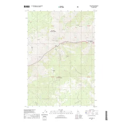
2020 Map of Carey Dome
USGS Topo · Published 2020About this map
Carey Dome stands as a prominent lookout over a landscape defined by the deep canyons of the Salmon River, specifically the protected corridor of the Salmon Wild and Scenic River. This 2020 map documents the transition between the Nez Perce National Forest to the north and the Payette National Forest to the south. The river corridor is marked by technical water features including Vinegar Creek Rapids and Chittam Rapids, alongside riverside locations like Tom Bar. Transportation in this remote territory relies on a network of forest development roads, including Natl Forest Develop Road 103 Rd and the Wind River Pack Bridge, which provides essential river access. Local landmarks such as Peterson Flat, Studebaker Saddle, and Warnock Ridge illustrate the high-relief topography of Idaho County.
Find a feature on this map
47 named features on this map. Tap any name to fly to it.
Don’t see what you’re looking for? This feature index may not catch every label — zoom into the map to look around manually.
Map Details
Editions of this 2020 Carey Dome Map
This is the sole edition of this map. No revisions or reprints were ever made.
Other maps of this area

1931 · Buffalo Hump
USGS Topo · 1:125,000

1934 · Buffalo Hump
USGS Topo · 1:125,000

1938 · Riggins
USGS Topo · 1:96,000

1945 · Riggins
USGS Topo · 1:125,000

1955 · Grangeville
USGS Topo · 1:250,000

1956 · Burgdorf
USGS Topo · 1:62,500

1956 · Elk City
USGS Topo · 1:250,000

1959 · Grangeville
USGS Topo · 1:250,000

1960 · Elk City
USGS Topo · 1:250,000

1963 · Hanover Mtn.
USGS Topo · 1:24,000