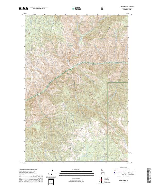
2024 Map of Carey Dome
USGS Topo · Published 2024About this map
The Salmon River carves a deep path through the center of this Idaho landscape, serving as a historic dividing line between several protected wilderness areas and national forests. North of the river, the Gospel-Hump Wilderness dominates the heights of Warnock Ridge and Black Butte, while the south bank marks the boundary of the Frank Church-River of No Return Wilderness. The map reveals a high-elevation network of ridges and saddles used for forest management and access, including Scott Saddle and Studebaker Saddle. Significant vertical relief is anchored by Carey Dome in the southern portion of the sheet. The drainage patterns of Hunts Creek, Bullion Creek, and Vinegar Creek illustrate the complex geography that has historically restricted major development, leaving a landscape defined by names like Peterson Flat and Corduroy Meadows.
Find a feature on this map
42 named features on this map. Tap any name to fly to it.
Don’t see what you’re looking for? This feature index may not catch every label — zoom into the map to look around manually.
Map Details
Editions of this 2024 Carey Dome Map
This is the sole edition of this map. No revisions or reprints were ever made.
Other maps of this area

1931 · Buffalo Hump
USGS Topo · 1:125,000

1934 · Buffalo Hump
USGS Topo · 1:125,000

1938 · Riggins
USGS Topo · 1:96,000

1945 · Riggins
USGS Topo · 1:125,000

1955 · Grangeville
USGS Topo · 1:250,000

1956 · Burgdorf
USGS Topo · 1:62,500

1956 · Elk City
USGS Topo · 1:250,000

1959 · Grangeville
USGS Topo · 1:250,000

1960 · Elk City
USGS Topo · 1:250,000

1963 · Hanover Mtn.
USGS Topo · 1:24,000