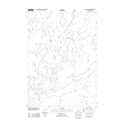
2012 Map of Caribou Creek
USGS Topo · Published 2012About this map
Hanson Sawmill stands at the northern reaches of this Johnson County landscape, where the drainages of Sourdough Creek and Rabbit Creek carve through the terrain. This 2012 survey illustrates a region defined by its seasonal watercourses and remote outposts, including the Muddy Creek Cow Camp and E-la-ka-wee Camp. The network of forestry and access roads like Sourdough Road and Pole Creek Road connects these isolated sites to more established points like the State Highway Maintenance Camp.
Find a feature on this map
33 named features on this map. Tap any name to fly to it.
Don’t see what you’re looking for? This feature index may not catch every label — zoom into the map to look around manually.
Map Details
Editions of this 2012 Caribou Creek Map
This is the sole edition of this map. No revisions or reprints were ever made.
Other maps of this area

1899 · Cloud peak
USGS Topo · 1:125,000

1900 · Fort McKinney
USGS Topo · 1:125,000

1901 · Cloud Peak
USGS Topo · 1:125,000

1903 · Fort McKinney
USGS Topo · 1:125,000

1955 · Sheridan
USGS Topo · 1:250,000

1958 · Sheridan
USGS Topo · 1:250,000

1962 · Sheridan
USGS Topo · 1:250,000

1967 · Caribou Creek
USGS Topo · 1:24,000
1967 · Hazelton
USGS Topo · 1:24,000
1967 · Hazelton Peak
USGS Topo · 1:24,000