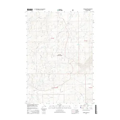
2015 Map of Caribou Creek
USGS Topo · Published 2015About this map
The Bighorn National Forest encompasses much of this landscape in Johnson County, Wyoming, defined by an intricate network of creeks and drainage basins. High-altitude hydrology is the primary feature of this area, where the N Fork Crazy Woman Cr and its tributaries, such as the Little N Fork Crazy Woman Cr, weave through the terrain alongside Caribou Creek and Sourdough Cr. Local travel is facilitated by a system of rural routes including Lost Cabin Rd, Hazelton Rd, and Pole Creek Rd, which provide access to significant water sources like Billy Creek Spring and the uniquely identified East Twin Park Spring Number 2. The map illustrates a region managed for its natural resources and watershed value, with a clear grid of public land surveys providing a framework for the named valleys and ridges.
Find a feature on this map
32 named features on this map. Tap any name to fly to it.
Don’t see what you’re looking for? This feature index may not catch every label — zoom into the map to look around manually.
Map Details
Editions of this 2015 Caribou Creek Map
This is the sole edition of this map. No revisions or reprints were ever made.
Other maps of this area

1899 · Cloud peak
USGS Topo · 1:125,000

1900 · Fort McKinney
USGS Topo · 1:125,000

1901 · Cloud Peak
USGS Topo · 1:125,000

1903 · Fort McKinney
USGS Topo · 1:125,000

1955 · Sheridan
USGS Topo · 1:250,000

1958 · Sheridan
USGS Topo · 1:250,000

1962 · Sheridan
USGS Topo · 1:250,000

1967 · Caribou Creek
USGS Topo · 1:24,000
1967 · Hazelton
USGS Topo · 1:24,000
1967 · Hazelton Peak
USGS Topo · 1:24,000