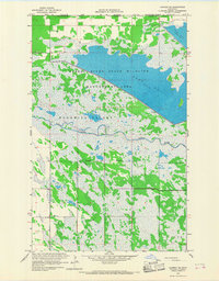
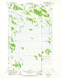
1966 Map of Caribou NE
USGS Topo · Published 1968About this map
The Canada United States border forms the northern limit of this mid-1960s landscape, where the Roseau River State Wildlife Management Area dominates the marshy terrain of northern Minnesota. This managed wilderness is defined by extensive water control projects, including Pool No 2 and Pool No 3, which support the regional wetland habitat. The Roseau River meanders through the central portion of the sheet, flanked by the low-lying expanse of Blooming Valley. To the south, the area around Soler and the Juneberry Cem provides a focal point for local history and genealogy, marking the sparse human footprint in this aqueous environment. The presence of State Ditch No 69 reflects the long-standing efforts to manage drainage and agriculture along the Manitoba Minnesota line during this era.
Find a feature on this map
12 named features on this map. Tap any name to fly to it.
Don’t see what you’re looking for? This feature index may not catch every label — zoom into the map to look around manually.
Map Details
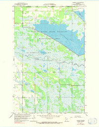
Editions of this 1966 Caribou NE Map
2 editions found
Other maps of this area

1919 · Badger
USGS Topo · 1:62,500

1930 · Juneberry
USGS Topo · 1:31,680

1932 · Juneberry
USGS Topo · 1:62,500

1952 · Thief River Falls
USGS Topo · 1:250,000

1956 · Thief River Falls
USGS Topo · 1:250,000

1957 · Thief River Falls
USGS Topo · 1:250,000
1966 · Haug
USGS Topo · 1:24,000
1966 · Badger NW
USGS Topo · 1:24,000

1966 · Caribou
USGS Topo · 1:24,000
1966 · Juneberry Ridge
USGS Topo · 1:24,000