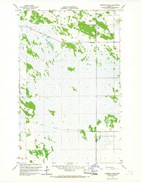
1966 Map of Juneberry Ridge
USGS Topo · Published 1967About this map
Juneberry Ridge rises slightly above the flat expanse of northwestern Minnesota, marking a landscape defined by an extensive network of drainage projects. This 1966 survey illustrates the precision of mid-century water management in the Red River Valley, where engineered channels like State Ditch No 72 and Judicial Ditch No 33 cut straight paths across the terrain to reclaim land for agriculture. The small settlement of Polonia sits near the border of Kittson and Roseau counties, representing the rural communities that took root in this cleared prairie and marshland. The map provides a detailed look at the interface between remaining wetlands, characterized by features like Moose Point, and the developing farmland. A small Gravel Pit along the ridge suggests the local extraction of glacial materials used for building the section-line roads that segment the territory.
Find a feature on this map
8 named features on this map. Tap any name to fly to it.
Don’t see what you’re looking for? This feature index may not catch every label — zoom into the map to look around manually.
Map Details
Editions of this 1966 Juneberry Ridge Map
2 editions found
Other maps of this area

1918 · Hemmington
USGS Topo · 1:62,500

1919 · Pelan
USGS Topo · 1:62,500

1930 · Juneberry
USGS Topo · 1:31,680

1932 · Juneberry
USGS Topo · 1:62,500

1952 · Thief River Falls
USGS Topo · 1:250,000

1956 · Thief River Falls
USGS Topo · 1:250,000

1956 · Karlstad
USGS Topo · 1:62,500

1957 · Thief River Falls
USGS Topo · 1:250,000

1957 · Pelan
USGS Topo · 1:62,500

1966 · Caribou
USGS Topo · 1:24,000