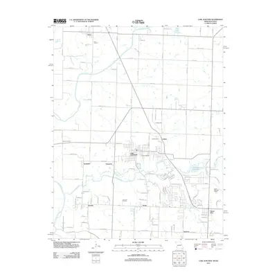
2011 Map of Carl Junction
USGS Topo · Published 2011About this map
Carl Junction serves as the central hub of this 2011 survey, situated at the confluence of several regional waterways and roads near the Missouri-Kansas border. The landscape is defined by the winding paths of the Spring River and Center Creek, which frame a series of small residential clusters and agricultural expanses. Local genealogy and history are well-represented by several burial grounds, including Waco Cemetery in the north and Howard Cemetery near the city center. To the east, the Joplin Municipal Airport and the community of Airport Drive indicate the continued suburbanization of the region. This map illustrates the transition from rural crossroads like Klondike and Thoms to more established residential developments near Oscie Ora Acres Lake, providing a clear look at the settlement patterns of Jasper County in the early 21st century.
Find a feature on this map
98 named features on this map. Tap any name to fly to it.
Don’t see what you’re looking for? This feature index may not catch every label — zoom into the map to look around manually.
Map Details
Editions of this 2011 Carl Junction Map
This is the sole edition of this map. No revisions or reprints were ever made.
Other maps of this area

1886 · Joplin
USGS Topo · 1:125,000

1886 · Carthage
USGS Topo · 1:125,000

1894 · Joplin
USGS Topo · 1:125,000

1894 · Carthage
USGS Topo · 1:125,000

1945 · Pittsburg
USGS Topo · 1:62,500

1947 · Joplin
USGS Topo · 1:250,000

1947 · Pittsburg
USGS Topo · 1:62,500

1949 · Joplin
USGS Topo · 1:250,000

1950 · Pittsburg
USGS Topo · 1:62,500

1954 · Joplin
USGS Topo · 1:250,000