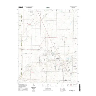
2015 Map of Carl Junction
USGS Topo · Published 2015About this map
Carl Junction serves as the central hub of this Missouri-Kansas borderlands survey, where the suburban growth of Joplin meets the rural agricultural landscape. The map captures a detailed network of small communities including Waco, Smithfield, Stringtown, and Klondike, illustrating the dense settlement pattern characteristic of this historic mining and farming region. These smaller locales are interconnected by a grid of county roads and Missouri state routes, such as Mo-Z, which navigate the terrain carved by the Spring River and Center Creek.
Find a feature on this map
88 named features on this map. Tap any name to fly to it.
Don’t see what you’re looking for? This feature index may not catch every label — zoom into the map to look around manually.
Map Details
Editions of this 2015 Carl Junction Map
This is the sole edition of this map. No revisions or reprints were ever made.
Other maps of this area

1886 · Joplin
USGS Topo · 1:125,000

1886 · Carthage
USGS Topo · 1:125,000

1894 · Joplin
USGS Topo · 1:125,000

1894 · Carthage
USGS Topo · 1:125,000

1945 · Pittsburg
USGS Topo · 1:62,500

1947 · Joplin
USGS Topo · 1:250,000

1947 · Pittsburg
USGS Topo · 1:62,500

1949 · Joplin
USGS Topo · 1:250,000

1950 · Pittsburg
USGS Topo · 1:62,500

1954 · Joplin
USGS Topo · 1:250,000