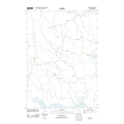
2012 Map of Carlile
USGS Topo · Published 2012About this map
Keyhole Reservoir dominates the southern reaches of this landscape, its fingers reaching into several drainages including N Deer Cr and Eggie Cr. This area of Crook County is characterized by a network of ridges and divides, with named features like Dakota Divide, Thorn Divide, and Pine Ridge separating the various creek basins that eventually feed the Belle Fourche River. Small ranching and residential points such as Green Hill Ranch and the community of Carlile are connected by a system of country roads like Thorn Divide Rd and Cabin Creek Rd. The presence of Monumental City and family-named landmarks like Eggie Basin provides essential geographic markers for researchers tracking the historical development of the region's topography and land use. To the west, Oil Butte stands out as a notable landmark overlooking the high plains terrain.
Find a feature on this map
34 named features on this map. Tap any name to fly to it.
Don’t see what you’re looking for? This feature index may not catch every label — zoom into the map to look around manually.
Map Details
Editions of this 2012 Carlile Map
This is the sole edition of this map. No revisions or reprints were ever made.
Other maps of this area

1905 · Devils Tower
USGS Topo · 1:125,000

1918 · Moorcroft
USGS Topo · 1:125,000

1918 · Moorcroft
USGS Topo · 1:62,500

1954 · Sunny Divide
USGS Topo · 1:24,000

1954 · Carlile
USGS Topo · 1:24,000

1954 · Missouri Buttes
USGS Topo · 1:24,000

1954 · Gillette
USGS Topo · 1:250,000

1955 · Devils Tower
USGS Topo · 1:62,500

1955 · Gillette
USGS Topo · 1:250,000

1957 · Nefsy Divide
USGS Topo · 1:62,500