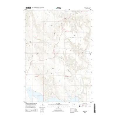
2015 Map of Carlile
USGS Topo · Published 2015About this map
Carlile sits at the northern end of this topographic study, where local roads like Cabin Creek Rd and Conestoga Dr weave through a terrain defined by ridges and deep drainages. The landscape is marked by a series of prominent divides, including Thorn Divide and Dakota Divide, which separate the watersheds of numerous creeks like Thorn Cr and Dry Cabin Cr. To the south, the waters of the Belle Fourche River flow toward the extensive Keyhole Reservoir, a major geographic feature that dominates the southwestern corner of the quadrangle along with Little Keyhole Lake.
Find a feature on this map
38 named features on this map. Tap any name to fly to it.
Don’t see what you’re looking for? This feature index may not catch every label — zoom into the map to look around manually.
Map Details
Editions of this 2015 Carlile Map
This is the sole edition of this map. No revisions or reprints were ever made.
Other maps of this area

1905 · Devils Tower
USGS Topo · 1:125,000

1918 · Moorcroft
USGS Topo · 1:125,000

1918 · Moorcroft
USGS Topo · 1:62,500

1954 · Sunny Divide
USGS Topo · 1:24,000

1954 · Carlile
USGS Topo · 1:24,000

1954 · Missouri Buttes
USGS Topo · 1:24,000

1954 · Gillette
USGS Topo · 1:250,000

1955 · Devils Tower
USGS Topo · 1:62,500

1955 · Gillette
USGS Topo · 1:250,000

1957 · Nefsy Divide
USGS Topo · 1:62,500