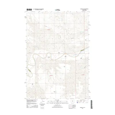
2015 Map of Carlin Flat
USGS Topo · Published 2015About this map
The Cheyenne River snakes through the heart of this landscape, defining the rugged boundary between Ziebach and Haakon counties. The river valley is flanked by wide, low-lying terraces including Arnold Bottoms and Carlin Bottoms, providing a sharp contrast to the surrounding tablelands. These high plains are marked by distinct topographical features such as Circle P Flats and Carlin Flat, which represent the open rangeland character of this central South Dakota region. Rural life and legacy are anchored at Buffalo Cem and along a network of remote tracks like Cherry Creek Rd and Bia-12. The drainage patterns are meticulously recorded, with numerous intermittent coulees such as Carlin Draw, Feeney Draw, and Robbs Draw carving into the upland flats. This survey provides a precise view of the land as managed through the Public Land Survey System, showing the township lines of T9N R23E and T9N R24E.
Find a feature on this map
23 named features on this map. Tap any name to fly to it.
Don’t see what you’re looking for? This feature index may not catch every label — zoom into the map to look around manually.
Map Details
Editions of this 2015 Carlin Flat Map
This is the sole edition of this map. No revisions or reprints were ever made.
Other maps of this area

1954 · Pierre
USGS Topo · 1:250,000

1956 · Kirley
USGS Topo · 1:24,000

1956 · Cherry Creek NW
USGS Topo · 1:24,000

1956 · Carlin Flat
USGS Topo · 1:24,000

1956 · Alleman Station
USGS Topo · 1:24,000

1956 · Cherry Creek
USGS Topo · 1:24,000

1958 · Pierre
USGS Topo · 1:250,000

1981 · Herbert Creek SW
USGS Topo · 1:24,000

1981 · High Elk Hill SE
USGS Topo · 1:24,000

1981 · High Elk Hill SW
USGS Topo · 1:24,000