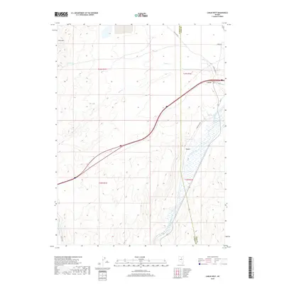
2018 Map of Carlin West
USGS Topo · Published 2018About this map
The Humboldt River corridor dominates the eastern edge of this modern survey, marking a vital transit and water artery where the settlements of Carlin, Tyrol, and Woodruff are situated. The landscape transitions from the river valley into the high desert elevations of Marys Mtn, punctuated by reliable water sources like Cherry Spring and Warm Spring. Local ranching and access routes are well-defined, with the Tomera Ranch Rd and James Creek Rd providing connectivity across the Eureka and Elko County line. The drainage of Buck Rake Jack Cr and Marys Cr illustrates the complex hydrology of this Great Basin environment, where seasonal water flow and perennial springs dictated the historical placement of roads and homesteads.
Find a feature on this map
19 named features on this map. Tap any name to fly to it.
Don’t see what you’re looking for? This feature index may not catch every label — zoom into the map to look around manually.
Map Details
Editions of this 2018 Carlin West Map
This is the sole edition of this map. No revisions or reprints were ever made.
Other maps of this area

1952 · Carlin
USGS Topo · 1:62,500

1955 · Winnemucca
USGS Topo · 1:250,000

1957 · Beowawe
USGS Topo · 1:62,500

1958 · Winnemucca
USGS Topo · 1:250,000

1958 · Huntsman Ranch
USGS Topo · 1:24,000

1962 · Winnemucca
USGS Topo · 1:250,000

1968 · Welches Canyon
USGS Topo · 1:24,000
1968 · Schroeder Mtn
USGS Topo · 1:24,000
1975 · Carlin NE
USGS Topo · 1:24,000

1985 · Scotts Gulch
USGS Topo · 1:24,000