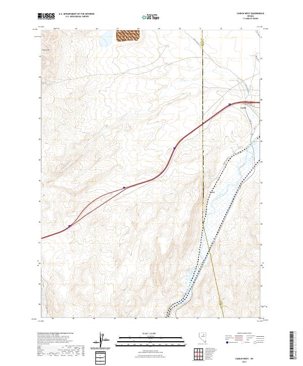
2021 Map of Carlin West
USGS Topo · Published 2021About this map
The Humboldt River corridor dominates this high-desert landscape, serving as a primary artery for both transportation and water in this corner of Eureka and Elko Counties. The settlement of Carlin sits at the northeastern edge of the sheet, where local streets like Chestnut St and Bush St give way to the rugged surroundings of Marys Mtn. To the south, the smaller settlement of Tyrol is positioned near the river, reflecting the historical dependence on this waterway for life in the Great Basin.
Find a feature on this map
19 named features on this map. Tap any name to fly to it.
Don’t see what you’re looking for? This feature index may not catch every label — zoom into the map to look around manually.
Map Details
Editions of this 2021 Carlin West Map
This is the sole edition of this map. No revisions or reprints were ever made.
Other maps of this area

1952 · Carlin
USGS Topo · 1:62,500

1955 · Winnemucca
USGS Topo · 1:250,000

1957 · Beowawe
USGS Topo · 1:62,500

1958 · Winnemucca
USGS Topo · 1:250,000

1958 · Huntsman Ranch
USGS Topo · 1:24,000

1962 · Winnemucca
USGS Topo · 1:250,000

1968 · Welches Canyon
USGS Topo · 1:24,000
1968 · Schroeder Mtn
USGS Topo · 1:24,000
1975 · Carlin NE
USGS Topo · 1:24,000

1985 · Scotts Gulch
USGS Topo · 1:24,000