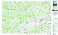
1984 Map of Carlisle
USGS Topo · Published 1985About this map
The parallel ridges of the Appalachian Mountains dominate this mid-1980s landscape, with Blue Mountain and Tuscarora Mountain defining the broad valleys of south-central Pennsylvania. Significant military installations anchor the region's mid-century footprint, notably the expansive Letterkenny Army Depot near the southwestern corner and the historic Carlisle Barracks situated at the heart of Carlisle. The map captures a well-developed transportation network where Interstate 81 and the Pennsylvania Turnpike intersect, tracing the ancient path of the Great Valley through Mechanicsburg and Shippensburg.
Find a feature on this map
245 named features on this map. Tap any name to fly to it.
Don’t see what you’re looking for? This feature index may not catch every label — zoom into the map to look around manually.
Map Details
Editions of this 1984 Carlisle Map
2 editions found
Other maps of this area

1892 · Harrisburg
USGS Topo · 1:62,500

1893 · Millersburg
USGS Topo · 1:62,500

1899 · Harrisburg
USGS Topo · 1:62,500

1900 · Mercersburg
USGS Topo · 1:62,500

1901 · Huntingdon
USGS Topo · 1:62,500

1902 · Chambersburg
USGS Topo · 1:62,500

1902 · Mercersburg
USGS Topo · 1:62,500

1904 · Huntingdon
USGS Topo · 1:62,500

1904 · Carlisle
USGS Topo · 1:62,500

1906 · New Cumberland
USGS Topo · 1:62,500