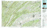
1984 Map of Carlisle
USGS Topo · Published 1989About this map
The Cumberland Valley and its defining mountain ridges dominate this mid-1980s landscape, anchored by the historic borough of Carlisle. This region is a major corridor for military and educational history, featuring the Carlisle Barracks, the Carlisle Indian Industrial School, and Dickinson College. Further southwest, the campus of Shippensburg University sits at the edge of the Cumberland and Franklin county line.
Find a feature on this map
267 named features on this map. Tap any name to fly to it.
Don’t see what you’re looking for? This feature index may not catch every label — zoom into the map to look around manually.
Map Details
Editions of this 1984 Carlisle Map
2 editions found
Other maps of this area

1892 · Harrisburg
USGS Topo · 1:62,500

1893 · Millersburg
USGS Topo · 1:62,500

1899 · Harrisburg
USGS Topo · 1:62,500

1900 · Mercersburg
USGS Topo · 1:62,500

1901 · Huntingdon
USGS Topo · 1:62,500

1902 · Chambersburg
USGS Topo · 1:62,500

1902 · Mercersburg
USGS Topo · 1:62,500

1904 · Huntingdon
USGS Topo · 1:62,500

1904 · Carlisle
USGS Topo · 1:62,500

1906 · New Cumberland
USGS Topo · 1:62,500