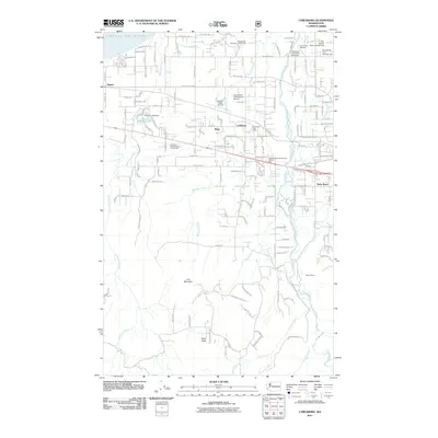
2011 Map of Carlsborg
USGS Topo · Published 2011About this map
The Dungeness River basin defines this 2011 survey, showing a landscape shaped by water management and aviation on the Olympic Peninsula. The settlement of Carlsborg serves as a central hub, flanked by the Carlsborg Post Office and two distinct aviation facilities: Grand View International Airport and Sequim Valley Airport. This era of the region’s development is marked by a sophisticated irrigation and water control network, evidenced by structures such as the Rex Aldrich Dam Number One and the Epperson Creek Fish Pond Dam. To the south, the terrain rises toward Lost Mountain and Texas Valley, contrasting the residential clusters of Agnew and River Road near the Strait of Juan de Fuca. Resource management remains vital to the local economy, seen in the operation of the Hurd Creek Hatchery and the Haller Quarry.
Find a feature on this map
44 named features on this map. Tap any name to fly to it.
Don’t see what you’re looking for? This feature index may not catch every label — zoom into the map to look around manually.
Map Details
Editions of this 2011 Carlsborg Map
This is the sole edition of this map. No revisions or reprints were ever made.
Other maps of this area

1918 · Port Angeles
USGS Topo · 1:62,500

1938 · Mt Constance
USGS Topo · 1:125,000

1938 · Dungeness
USGS Topo · 1:62,500

1939 · Dungeness
USGS Topo · 1:62,500

1941 · Port Angeles
USGS Topo · 1:62,500

1944 · Mt. Angeles
USGS Topo · 1:62,500

1946 · Mt. Angeles
USGS Topo · 1:62,500

1946 · Tyler Peak
USGS Topo · 1:62,500

1948 · Tyler Peak
USGS Topo · 1:62,500

1956 · Sequim
USGS Topo · 1:24,000