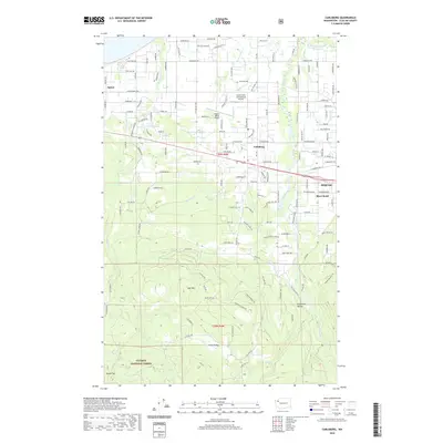
2020 Map of Carlsborg
USGS Topo · Published 2020About this map
Sequim and its surrounding agricultural valley are defined by the Dungeness River as it flows toward the Strait of Juan de Fuca. This modern survey illustrates the residential expansion of the Olympic Peninsula, where small settlements like Carlsborg and Agnew serve as hubs between the coast and the rising timberlands. Aviation history is prominent with both the Sequim Valley Airport and Grand View International Airport situated on the outskirts of town.
Find a feature on this map
87 named features on this map. Tap any name to fly to it.
Don’t see what you’re looking for? This feature index may not catch every label — zoom into the map to look around manually.
Map Details
Editions of this 2020 Carlsborg Map
This is the sole edition of this map. No revisions or reprints were ever made.
Other maps of this area

1918 · Port Angeles
USGS Topo · 1:62,500

1938 · Mt Constance
USGS Topo · 1:125,000

1938 · Dungeness
USGS Topo · 1:62,500

1939 · Dungeness
USGS Topo · 1:62,500

1941 · Port Angeles
USGS Topo · 1:62,500

1944 · Mt. Angeles
USGS Topo · 1:62,500

1946 · Mt. Angeles
USGS Topo · 1:62,500

1946 · Tyler Peak
USGS Topo · 1:62,500

1948 · Tyler Peak
USGS Topo · 1:62,500

1956 · Sequim
USGS Topo · 1:24,000