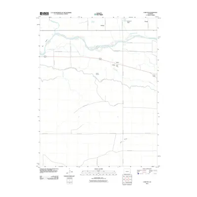
2010 Map of Carlton
USGS Topo · Published 2010About this map
The Arkansas River serves as the central artery of this high plains landscape, dictating the placement of the region's complex water management infrastructure. Local agricultural life is anchored by several small settlements and landmarks, most notably Carlton and its Carlton Post Office, alongside the nearby community of Grote. The intricate network of irrigation is visible through numerous engineered waterways such as the Manvel Canal, Lamar Canal, and Fort Bent Canal, which draw from the river to support the surrounding fields. Further north, the Cottonwood Number 2 Dam and Goodale Slough near the settlement of Goodale illustrate the continued effort to manage surface water in this arid environment. The map also captures distinctive geographic features like the Big Timbers and Smith Arroyo, providing a clear view of the rural township and range system that organizes Prowers County.
Find a feature on this map
32 named features on this map. Tap any name to fly to it.
Don’t see what you’re looking for? This feature index may not catch every label — zoom into the map to look around manually.
Map Details
Editions of this 2010 Carlton Map
This is the sole edition of this map. No revisions or reprints were ever made.
Other maps of this area

1890 · Granada
USGS Topo · 1:125,000

1891 · Albany
USGS Topo · 1:125,000

1892 · Lamar
USGS Topo · 1:125,000

1892 · Granada
USGS Topo · 1:125,000

1892 · Two Butte
USGS Topo · 1:125,000

1893 · Two Butte
USGS Topo · 1:125,000

1893 · Albany
USGS Topo · 1:125,000

1894 · Granada
USGS Topo · 1:125,000

1952 · Carlton
USGS Topo · 1:24,000

1953 · Granada
USGS Topo · 1:24,000