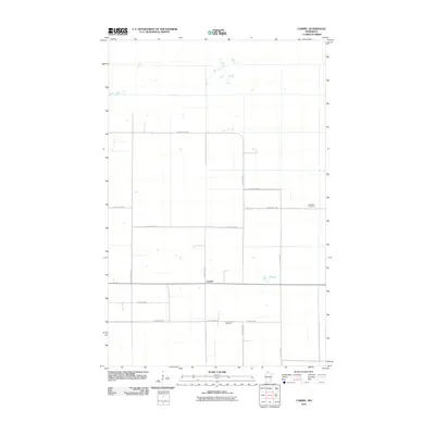
2010 Map of Carmel
USGS Topo · Published 2010About this map
Carmel serves as the focal point of this northern Minnesota landscape, where a rigid grid of rural roads defines the pattern of settlement and land use. The topography is subtle, marked primarily by the intersection of throughways like County Hwy 700 and Carmel Rd NW. For genealogists and local historians, the presence of Our Saviours Cemetery and Sundberg Cemetery provides specific points of interest for family research in this Beltrami County township. The map reveals a transition into more wetland-prone areas to the north, indicated by the less dense road network and scattered drainage patterns beyond Benville Rd NW. The naming of the local roads, such as Gunpowder Rd NW and Settler Rd NW, evokes the character of the late 20th and early 21st-century rural expansion in this region.
Find a feature on this map
16 named features on this map. Tap any name to fly to it.
Don’t see what you’re looking for? This feature index may not catch every label — zoom into the map to look around manually.
Map Details
Editions of this 2010 Carmel Map
This is the sole edition of this map. No revisions or reprints were ever made.
Other maps of this area

1918 · Malcolm
USGS Topo · 1:62,500

1918 · Jelle
USGS Topo · 1:62,500

1919 · Liner
USGS Topo · 1:62,500

1954 · Roseau
USGS Topo · 1:250,000

1957 · Roseau
USGS Topo · 1:250,000

1958 · Roseau
USGS Topo · 1:250,000

1973 · Gates Corner
USGS Topo · 1:24,000
1973 · Grygla
USGS Topo · 1:24,000
1973 · Erie NE
USGS Topo · 1:24,000

1973 · Jelle NE
USGS Topo · 1:24,000